‘The beach is more like a dance than a place’
How erecting a wall to preserve the location of a beach may actually end up destroying it. (A Photo Essay)
“Roll on, thou deep and dark blue Ocean – roll! Ten thousand fleets sweep over thee in vain; Man marks the earth with ruin – his control stops with the shore…”. – An excerpt from Lord Byron’s 1812 narrative poem, Childe Harold’s Pilgrimage
Little Crescent Beach, Nova Scotia
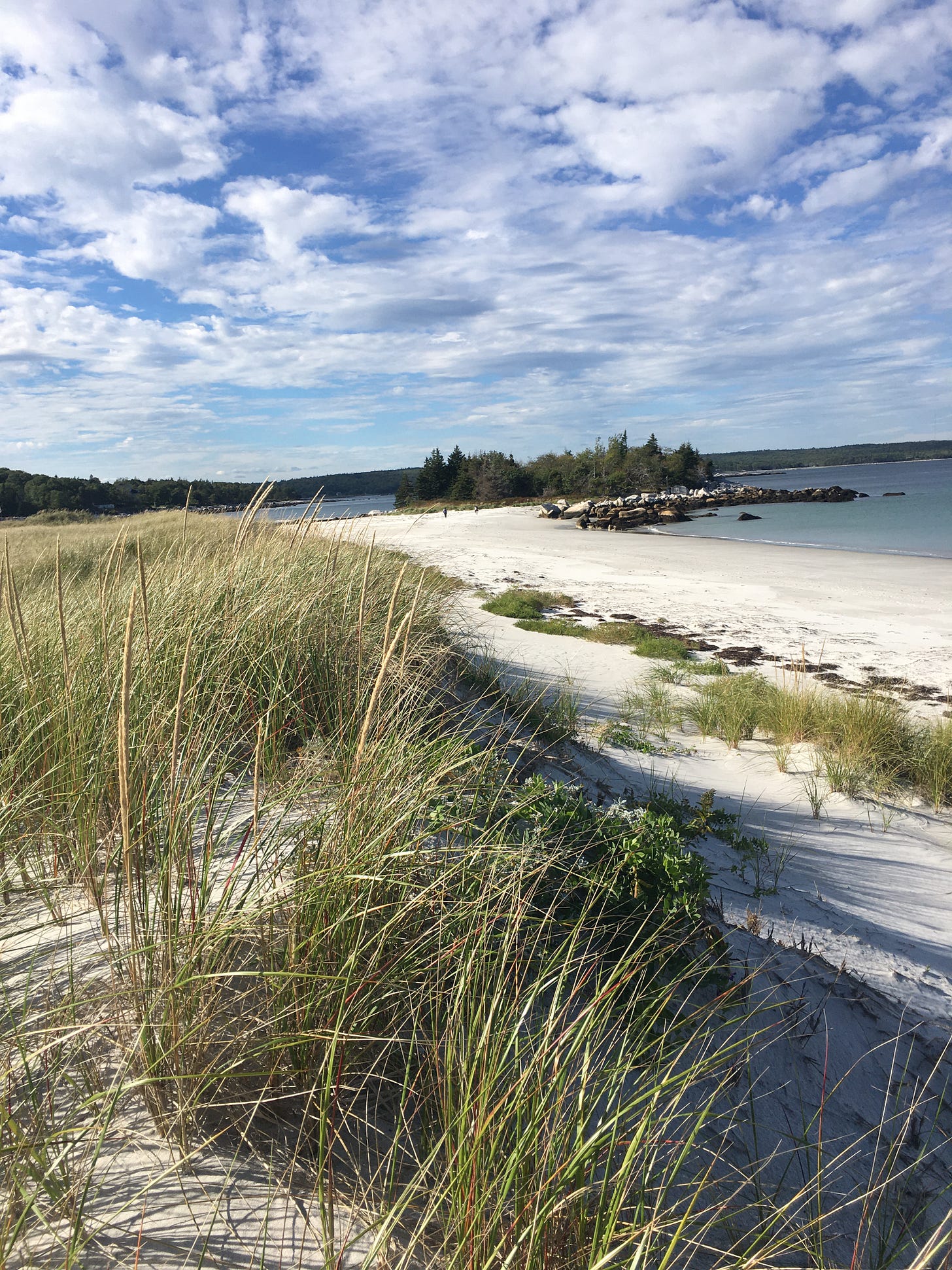
In summer, the 2 km long, and roughly 50 m wide sand bar known as Crescent Beach near West Dublin, Nova Scotia, is a lot like a thoroughfare. There are essentially two roads—a paved one behind the dunes running the length of the backshore, connecting the mainland to the Cape LaHave Islands— and another road of sorts, running the length of the sandy beach itself. I think it might be the only beach in the province that allows vehicles on the sandy berm. On a typical summer day, cars and trucks are parked perpendicular to the dunes, and beach goers set up their folding chairs and umbrellas near their cars rather than further down the foreshore. That area is reserved for vehicles coming and going.
Top: Crescent Beach; Bottom: Satellite map showing Crescent, and Little Crescent beaches, as well as some of the LaHave Islands.
In many ways Crescent Beach is a launching point, a gateway to some of the most beautiful scenery the province has to offer. Shorebirds congregate in the sheltered inlets and secluded coves, and an array of living organisms inhabit the tidal flats and salt marshes. For instance, if you venture to the end of Crescent Beach, beyond where the backshore road continues onwards to connect a series of islands —George, Bush, Jenkins, Bell, and Lahave—you will come to what’s referred to as Little Crescent: a peaceful, gently curving gem of white sand. For many, it is like being in paradise. At least until very recently.
A couple of weeks back, local residents noticed a 130-metre-long rock wall being built along the shoreline of Little Crescent beach by a private landowner, who says the new wall was needed to replace existing sea walls that had been badly damaged. There have been a number of news reports on the subject, that can be found here, and here.
A community meeting held at the Petite Riviere Fire Hall attracted more than a hundred concerned citizens, and was also attended by the Mayor of the Municipality of Lunenburg, Carolyn Bolivar-Getson, as well as members of the Department of Natural Resources & Renewables (DNRR) and the Department of Environment and Climate Change (NSECC). A Web page dedicated to the protection of the province’s coastal environment has also been created, with a petition and letter-writing campaign. The group is calling for the creation of Land Use By Laws and Zoning to address coastal protection.
Residents say the wall not only encroaches on crown land, but it disturbs a nearby tidal marsh—an ecologically diverse habitat. The development and construction of the wall also goes against the spirit of a recent provincial legislation that aims to protect coastal habitat from development like this. The group is calling for a moratorium on all coastal developments until the legislation is in force.
But there’s no telling when that might be.
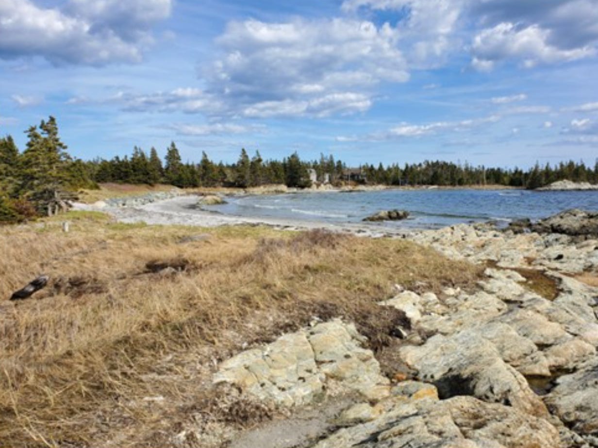
Before and after photos of Little Crescent Beach. The top photo posted by Tanya Ramey (Facebook) was reportedly taken 50 years ago. The bottom photo is from John Bell’s FB page. According to Paul Newton, who reposted these on his FB page, the beach has already lost a lot of sand and dune over the fifty-year period. Newton asks, is the loss a result of rising seas or the “natural evolution of beaches over time, or accelerated erosion from the smaller rock wall that predated the current wall?” Newton has a prediction — the new wall will destroy the beach — a subject we’ll return to.
The Coastal Protection Act received royal assent in April of 2019, and since then the NSECC says it has been working on the regulations which are specifically focused on restricting development in places where it will put properties at risk from coastal erosion, sea level rise and coastal flooding in the coming decades. But the regulations will also be aimed at restricting development where it will damage valuable coastal ecosystems.
In an article written for The Engineer, John Somers from NSECC writes that the Act and the regulations will “prevent development and activity that damages the environment by interfering with the natural dynamic and shifting nature of the coast.”
According to the report of public input received during the summer 2021 consultation period concerning the regulations for the Act, there was widespread support for the regulations. In fact, the vast majority wanted them to be tougher: 77% of public submissions found that the proposed regulations were “not restrictive enough,” while 12% found them to be “too restrictive,” and 11% said they were “appropriate.”
Common themes that emerged related to the need to protect sensitive ecosystems, the regulation of activities below the ordinary high-water mark, the importance of enforcement, and the protection of existing structures.
A primary concern raised was what version of the high-water mark the province will use in delineating the Coastal Protection Zone. Respondents wanted to ensure the province understood the importance of having an accurate measurement of this reference point.
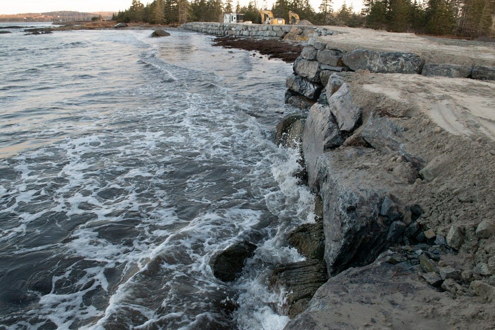
Screen grab of Youtube video showing new rock wall built at Little Crescent beach.
Another “common concern” raised during the consultation was that the scope of the regulations should be expanded, and a broader range of structures and activities should face development restrictions. Many emphasized the need to further restrict development activities below the ordinary high-water mark (OHWM), such as shoreline armouring and infilling, and called for the scope of the regulations to include private water lots and tidal and submerged Crown land.
From the public consultation report:
A common concern was whether sensitive ecosystems such as wetlands, salt marshes and estuaries would be adequately protected. Many called for additional detail to ensure this, for example, clear definitions, criteria, and processes for determining sensitive areas, and some called for stricter development restrictions in certain sensitive areas. The need to protect the riparian zone was mentioned as an issue requiring attention and some respondents called for the addition of a no-development, vegetative buffer zone along the shoreline edge of the Coastal Protection Zone to further protect coastal ecosystems. Another common concern raised by those who felt ecosystems may not be adequately protected was the need to regulate activities more strictly below the high-water mark, including infilling, armouring and shoreline stabilization, which pose special risk to coastal ecosystems and their ability to adapt to changing climate conditions. Respondents from all groups highlighted the need for effective enforcement to ensure coastal ecosystems are protected in practice
Everyone seems to agree, the “ordinary” high-water mark isn’t something that should be open to interpretation. It’s defined as “the mark reached by the average of the mean high tides” and when it’s surveyed it’s “typically based on visual observations and can be relatively subjective depending on the season and timing of the survey,” according to a report by Engineers Nova Scotia.
However, it can generally be identified from a wrack line, i.e. the line of debris left by high tide, or from a change in colour from light to dark on rocks. In time, for consistency, the Higher High Water Large Tide (HHWLT) should be the standard high water metric, to form part of the Province’s coastal mapping database. For the foreseeable future and for practicality in the field, the high water mark will be defined in the field as the strand line of debris near the top of the beach left by high tide during a spring tidal cycle with calm wave conditions.
A section of the newly constructed rock wall appears to be well below the high water mark. Photo: Peter Barss (Facebook)
According to the proposed regulations, the “coastal protection zone”—where the regulations will apply—would be a “narrow band surrounding the province’s coast, including land and water-covered areas on either side of the high-water mark… government is proposing the inland portion extend inland from the high-water mark by in the range of 80 to 100 metres.”
This “single consistent distance” would be determined following consultation, and it is meant to not only inform vertical and horizontal building setbacks to reduce risk to the structures from coastal erosion, but also to set standards for shoreline structures so that coastal ecosystems are protected.
This is clearly not happening at Little Crescent Beach. Not by a long shot.
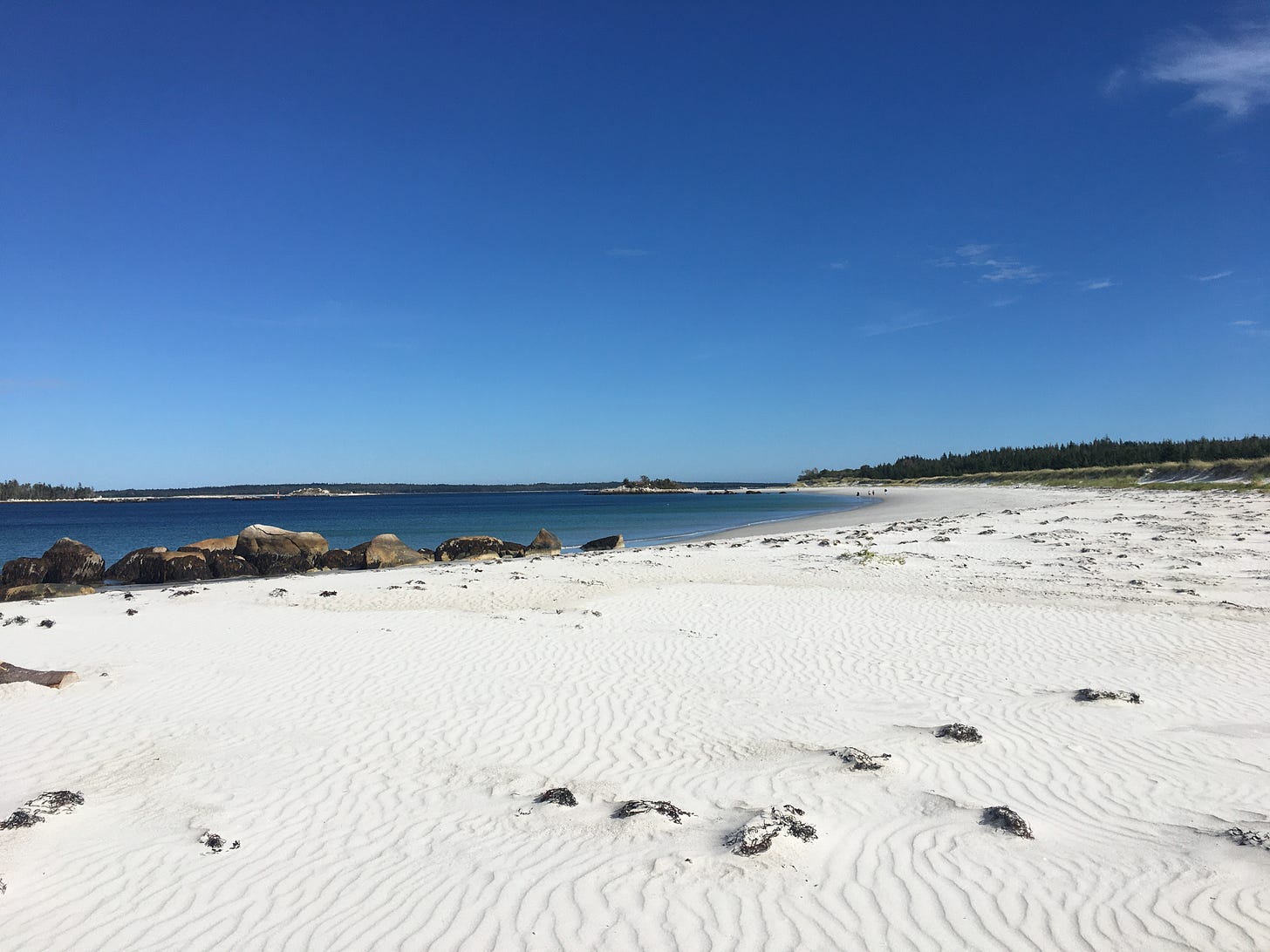
Carter’s Beach near Port Mouton, Nova Scotia. My favourite beach. Photo: Linda Pannozzo
In his book The Living Beach: Life, Death, and Politics where the Land Meets the Sea, the late Silver Donald Cameron, an acclaimed and prolific Canadian author and co-author of nearly 20 books, tells the story about meeting Bob Taylor in 1988. Taylor was a scientist working at the Bedford Institute of Oceanography and Cameron had just been hired by the federal government to write a series of short radio spots on coastal ecology. As Cameron tells it, Taylor was explaining how “a beach under stress moves its underwater bar offshore to protect itself from storm waves. When the storm has passed, it relaxes and moves the bar shoreward again.”
Cameron replied, “Wait a minute, you talk as though the damn thing were alive.”
“I think of it that way,” said Taylor.
The realization became the kernel that Cameron developed further into magazine pieces, documentaries for CBC radio and Vision television, and eventually—ten years after his initial encounter with Taylor—into his 1998 book, which was revised and republished in 2014.
For Cameron, “the beach is… a frontier, a paradox. At once stable and volatile, it is more like a dance than a place.”
Carter’s Beach. Photo: Linda Pannozzo
In a 2014 interview conducted on a beach in Parrsboro, Nova Scotia, journalist Bruce Wark asked Cameron what a beach actually is? Cameron replied that while we often think of a beach as the berm—the white sandy stretch above the high water mark “where we spread our blankets”—in fact, it is much more expansive than that.
It begins wherever the land-based vegetation and ecological features leave off—the edge of the farmer's field, the edge of the forest—then it goes through usually a lagoon or a back patch that's also tidal, a salt marsh or something of that kind, then down over the berm and then down the beach face and ultimately out to sea. The usual sense of where the limit is out to sea is it goes out to the deepest water at which the waves can still move sediments, and that can be 50, 60, 100 feet. So, the beach in many cases looks to our eyes as though it's a few yards wide, but in fact, it may be six or seven miles wide, and that's not the way we normally think of a beach, but it's the whole system and it's all constantly in motion.
In his book, Cameron describes how a beach can transform and yet retain its individual character. He describes two broad categories of waves and how they will sculpt and shape the beach and determine not only what settles, but how it does.
Cameron writes:
Constructive waves produce spilling breakers—breakers that simply seem to crumble at their caps. As they tumble forward, spilling breakers nudge sand up the beachface in a slowly dissolving froth called the swash. The water curls up the beach and sinks into the beachface, leaving some of its sand a burden behind.
High energy waves, which are usually associated with strong winds and storms, produce plunging breakers—surfers’ waves, glossy tubes of water that rear up high, curl forward and break straight downward, yielding a strong backwash and very little swash. Plunging breakers are destructive waves that pull sand and other sediments back down the beach and out under the water. Beyond the surf zone, the backwash loses its energy. The sand settles, and currents along the shore shape it into a bar.
The beach is using the energy of the waves to defeat them … [T]he migration of the sand is the beach’s defense, lengthening and flattening the whole shoreface, forcing the seas to break further offshore. When the winter storms are over, the spilling breakers patiently resume their work of carrying the sand back up the beach until the bar welds itself into the beachface, restoring the broad and sandy beach of summer. The beach relaxes, sprawling in the sun.
Taken from different angles, and at different points in the tide cycle: Fox Point beach near Hubbards, Nova Scotia, in winter (left) and summer (right). The beach undergoes dramatic seasonal changes as a result of a shift in wave energy. In winter, the storm waves pull the sand offshore, leaving much of the beach covered in cobbles. In summer, the more gentle waves return the sand onshore, creating a wider sand beach.
According to Cameron, who devoted an entire chapter in his book to the “Armoured Beach,” when we try to “preserve the location of the beach” by building walls and erecting fortifications of various sorts, “that actually kills the beach. The beach disappears… we don't know how sea walls have that effect, but we see that it will actually eliminate the beach over time.”
So, it’s possible that the rock wall erected at Little Crescent beach might have an unintended consequence, one that the new law should also address.
Beaches are continuously changing, shifting, living, systems.
Thwart this life force at your peril.
I’d like to give the final word to Cameron:
For me, the beach emerges as an eternal process with a perpetually mutable form, an ever-shifting boundary, an image at once of change and stability. It is a paradox, a union of opposites. It reveals that stability is an illusion—and that change is also an illusion. It thus brings us face to face with perhaps the greatest theme in literature, science and philosophy: the nature of time and human dismay at our own meager allotment of it. The span of a human lifetime is the flare of a match against endless darkness; but it is all the time we have.
Nowhere in our normal experience is the great unity of things -- even of stability and change-- more available to our apprehension than it is at the beach. Ultimately, looking at the tumbling waves and the restless sands, we are looking into the nature of reality: ceaseless variety within an eternal process.
We may even perceive that each of us, too, is a process, a part of the great Process, and that both reverence and joy should flavour our own brief dance upon the sands.
Silver Donald Cameron, June 21, 1937 – June 1, 2020 (aged 82). I had the honour and pleasure of working with Don (and Chris Beckett) for ten years on The Green Interview. He was a mentor, colleague, and friend, and is sorely missed.


Excellent, and sad, article, Linda! We’ve spent many happy hours at Crescent and Little Crescent. One of our favourite places in the world. It’s so devastating to see this mindless, entitled and destructive “development “.
Powerful stuff. I hope lots of people, including ones with power, read it.
Bill McKay